Across Ontario · Halton Region

Milton

A town that has grown quickly along the 401 below the escarpment, with an old downtown on the Mill Pond and quiet country to the west.

Map of Milton: main roads and highways, rivers, parks, and a few landmarks. Each part of town in this guide is marked; choose one to jump to itMilton401407Old MiltonEast sideSouth MiltonCampbellville
Point to a part of town or a landmark, or tap itMap data © OpenStreetMap contributors
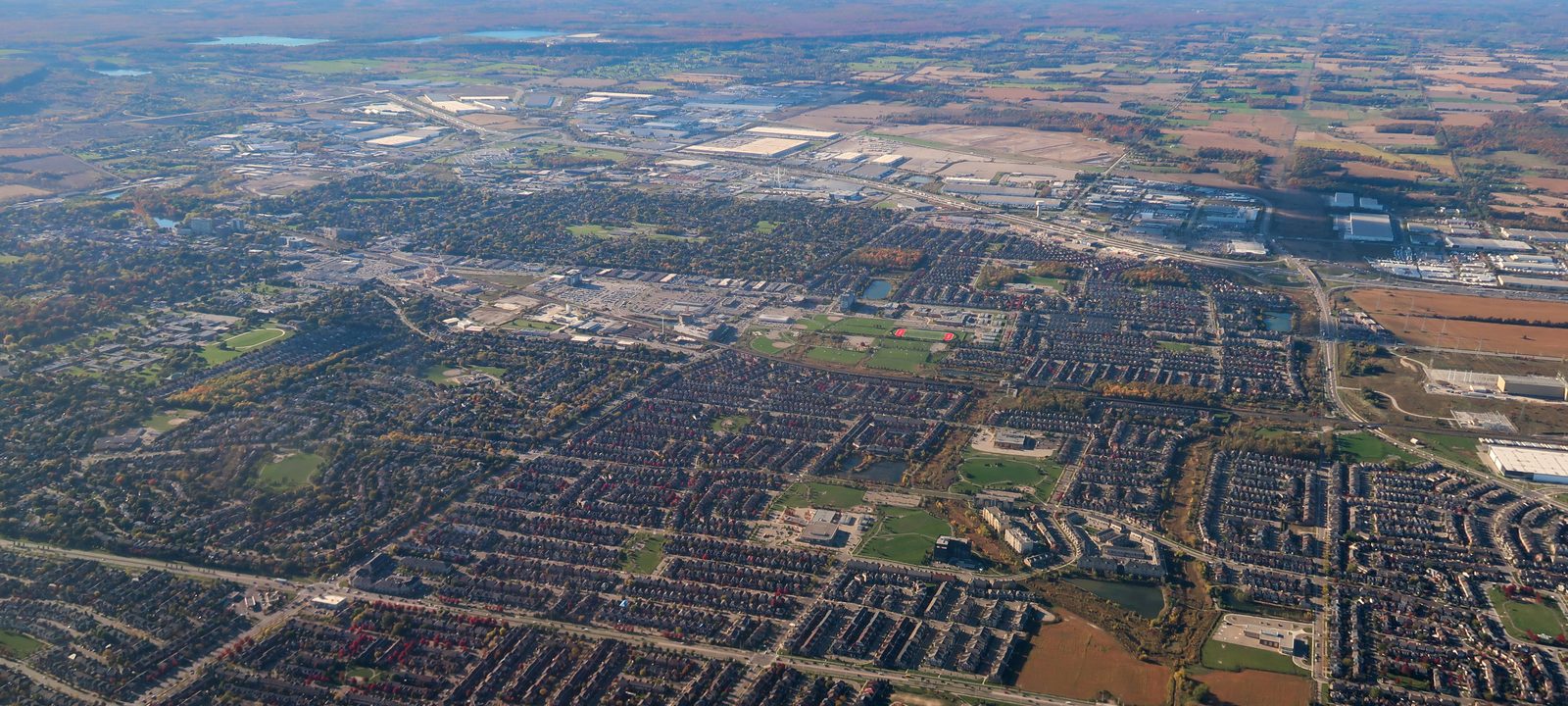
An aerial view over Milton’s newer neighbourhoods, rows of streets and rooftops stretching toward farmland on the horizon
Milton from the air, looking over the newer neighbourhoods.
Photo: Canmenwalker, CC BY 4.0

About Milton

Milton sits on Highway 401 about 54 kilometres west of downtown Toronto, at the western end of the GO Milton line. It was the fastest growing municipality in Canada between 2001 and 2011, and about 133,000 people lived here in 2021.

The town grew from a mill on Sixteen Mile Creek. Most of it is new, built after a pipeline from Lake Ontario opened the way for growth in the early 2000s. West of the urban area the Niagara Escarpment rises sharply, and Conservation Halton runs five large parks in the town.

The Town of Milton divides the urban area into named neighbourhoods, many of them named for early families, and the guide follows those names. It starts in Old Milton.
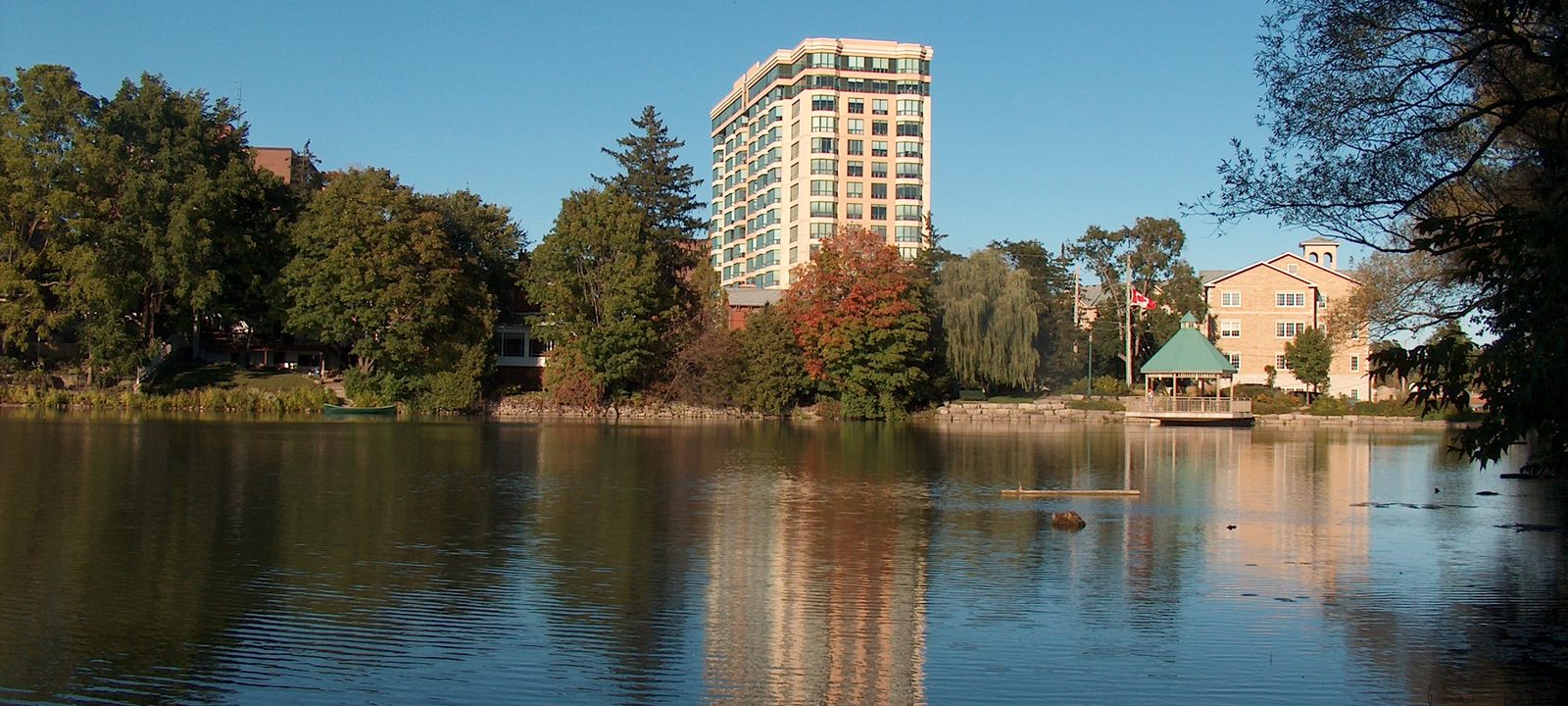
The Mill Pond in Milton on a clear autumn day, with trees in fall colour, a white apartment tower, and the old downtown reflected in the water
The Mill Pond, at the edge of downtown.
Photo: Decimal10, CC BY-SA 3.0

Where it began

Old Milton and the Mill Pond

Jasper Martin came from Newcastle upon Tyne in 1818, took up a Crown grant on Sixteen Mile Creek in 1820, and built a grist mill there. The pond he made to power it is the Mill Pond, still in the middle of town. By 1837 about a hundred people lived around the mill, and the settlement was named for the poet John Milton. It became a town in 1857.

In the early 1900s Milton was home to the P.L. Robertson Manufacturing Company, which made the square socket screw that Robertson invented.

Through the year

A farmers’ market closes part of Main Street on Saturday mornings from May through October. The Milton Fall Fair, held on the fairgrounds near downtown on the last weekend of September, has been going for more than 160 years, and the Downtown Milton Street Festival fills Main Street each June. The FirstOntario Arts Centre, run by the town, opened in 2012.

Around downtown

Mountain View and Dorset Park

Neighbourhoods just north of downtown. Dorset Park, between Main Street, Steeles Avenue, Ontario Street, and Thompson Road, is mostly homes from the 1970s on generous lots.

Timberlea

Timberlea, east of Ontario Street South, was one of the big projects of the late 1970s, built out to about 1,400 homes. After it was finished, very little was built in Milton for about twenty years, until the new water supply arrived.

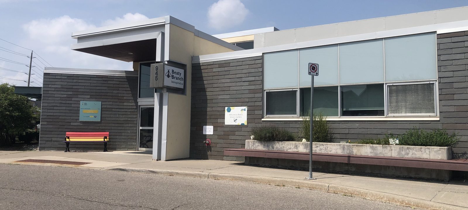
The Beaty branch of the Milton Public Library, a low modern building with dark and light panels and large windows, under a blue sky
The Beaty branch library, on Fourth Line.
Photo: VeryTallTrees, CC BY-SA 4.0

Near the GO

The east side

Many of Milton’s newer neighbourhoods are east of the old town, between downtown, the GO station, and the 401. The town calls them Dempsey, Clarke, Beaty, and, furthest east, Bowes. Wyldewood, Royal Ontario, and Piper’s Heath, three golf courses a few minutes apart, are all on Trafalgar Road, east of the town centre.

The Milton GO station is here, and so is the Main Library on Main Street East. Trains on the Milton line run inbound to Toronto in the weekday morning and back in the evening, and GO buses fill in the rest of the day.

Neighbourhoods

Dempsey and Clarke

Between Thompson Road and James Snow Parkway, closest to the 401 and the GO station.

Beaty

One of the largest neighbourhoods in town, with its own branch library on Fourth Line.

Toward the escarpment

The south and west

South of Derry Road the town keeps growing toward Britannia Road and beyond. Scott sits closest to the escarpment, with the Sherwood Community Centre and library branch on Main Street West. Willmott has the Milton Sports Centre, and Coates, Cobban, Ford, Harrison, and Walker continue south and east.

The Mattamy National Cycling Centre on Pan Am Boulevard was built for the 2015 Pan American Games. It was the first indoor velodrome of its class in Canada, and it is now home to Cycling Canada’s track program as well as a community gym, walking track, and courts. Milton District Hospital is on Bronte Street South. RattleSnake Point Golf Club, a private ClubLink club with 36 golf holes, is on Regional Road 25.

Neighbourhoods

Scott

On the west side near the escarpment, with the Sherwood Community Centre.

Willmott and Coates

South of Derry Road, with the Milton Sports Centre in Willmott.

Harrison, Ford, Cobban, and Walker

The newer neighbourhoods of the south end, toward Britannia Road.

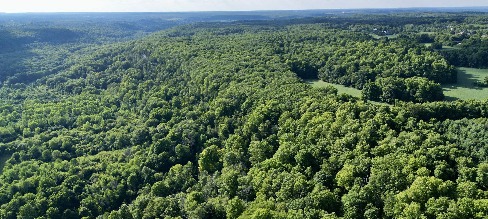
An aerial view of the Niagara Escarpment near Rattlesnake Point, a deep green forest canopy stretching to farmland under a blue sky
The Niagara Escarpment above Rattlesnake Point.
Photo: Bryanmackinnon, CC BY-SA 4.0

The rural west

Campbellville and the escarpment

Campbellville is named for John Campbell, who settled here in 1832. It was the main village of Nassagaweya Township, which became part of Milton in 1974. Today it is a small village on the escarpment close to the 401 at Guelph Line, with furniture shops, an ice cream parlour, and the Halton County Radial Railway museum nearby. Woodbine Mohawk Park, the harness racing track, opened here in 1963. North of the village, on Guelph Line, Turtle Creek is a public golf course in rolling country on top of the escarpment.

The escarpment parks are what draw most people west. Kelso has a swimming beach on a reservoir built to control Sixteen Mile Creek, and Glen Eden runs ski hills inside it. Rattlesnake Point has cliffs and caves popular with hikers and climbers. At Crawford Lake, the layered mud on the lake bottom has kept a record of centuries of local history, and a Wendat village has been reconstructed beside it.

Sources

We wrote this guide from the public sources listed here, and checked each place against them. Neighbourhood names follow local usage, the streets named are examples rather than boundaries, and the marks on the map are approximate. Details such as school boundaries, zoning, and transit routes change, so please check anything important with the municipality or the school board.