Across Ontario · Halton Region

Oakville

A lakeside town with a historic downtown at the mouth of Sixteen Mile Creek, an old fishing village to the west, and newer neighbourhoods running north toward the 407.

Map of Oakville: main roads and highways, rivers, parks, and a few landmarks. Each part of town in this guide is marked; choose one to jump to itOakvilleLAKE ONTARIOBronte Creek403407DowntownBronteGlen AbbeyThe north
Point to a part of town or a landmark, or tap itMap data © OpenStreetMap contributors
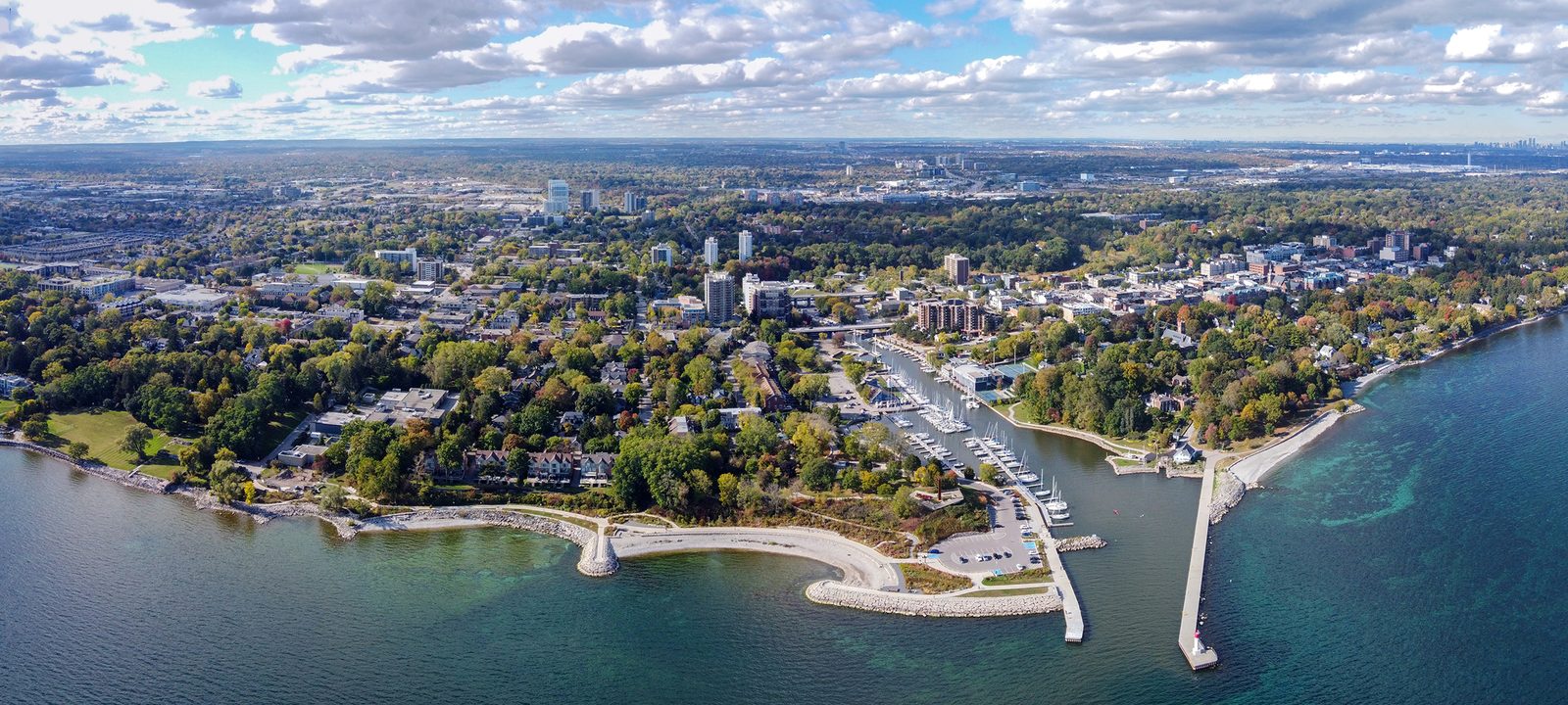
An aerial view of Oakville’s shoreline on Lake Ontario, with a harbour, breakwaters, parkland, and neighbourhoods running inland
Oakville’s shoreline on Lake Ontario, from the air.
Photo: Canmenwalker, CC BY 4.0

About Oakville

Oakville is a lakeside town between Burlington and Mississauga, with its old downtown by the harbour at the mouth of Sixteen Mile Creek and neighbourhoods running north toward Milton. It is the seat of Halton Region, and about 214,000 people lived here in 2021.

It grew from the land around the mouths of Sixteen Mile Creek and Twelve Mile Creek, which the Mississaugas kept when they sold the surrounding land in 1805. In 1827 the land at Sixteen Mile Creek was sold to William Chisholm, who started a shipbuilding business and a harbour town. In 1962 Oakville joined with Bronte, Palermo, Sheridan, and the rest of Trafalgar Township to form the town of today.

Two creeks cut wooded valleys through the town, and the QEW and Highway 403, Highway 407, and the Lakeshore West GO line all cross it. The guide starts at the lake and works north.
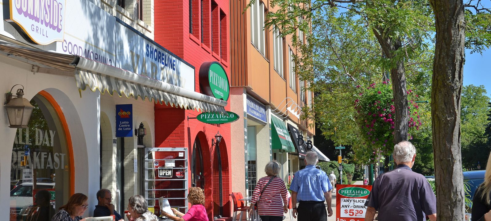
People walking past shops and café tables under shade trees on Lakeshore Road East in downtown Oakville
Lakeshore Road East, in downtown Oakville.
Photo: Ontario Ministry of Municipal Affairs and Housing, CC BY 2.0

By the harbour

Downtown and Old Oakville

Downtown Oakville runs along Lakeshore Road East, close to where Sixteen Mile Creek meets the lake. By 1846 about 1,500 people lived here, shipping wheat and lumber by schooner. Basket making became a big local trade in the 1850s, and Oakville was one of the stops on the Underground Railroad, where people escaping slavery in the United States made new lives. The first electric lights in town went up in 1889, on the west side of the creek in what is now Harbour Grove.

Old Oakville became the town’s first heritage conservation district in 1981, and its tree lined streets of older homes run between the downtown and the lake. The Oakville Museum and the Oakville Centre for the Performing Arts are both on Navy Street, beside the harbour, and Lakeside Park is beside the harbour.

Along the lake

East of downtown, Oakville Galleries shows contemporary art at Gairloch Gardens, on Lakeshore Road East. To the west, Appleby College, a private school founded in 1911, is on Lakeshore Road West.

Around downtown

Old Oakville

The heritage district between downtown and the lake, with some of the oldest homes in town.

Kerr Village

Kerr Street, just west of the creek, has its own business area of shops and restaurants.

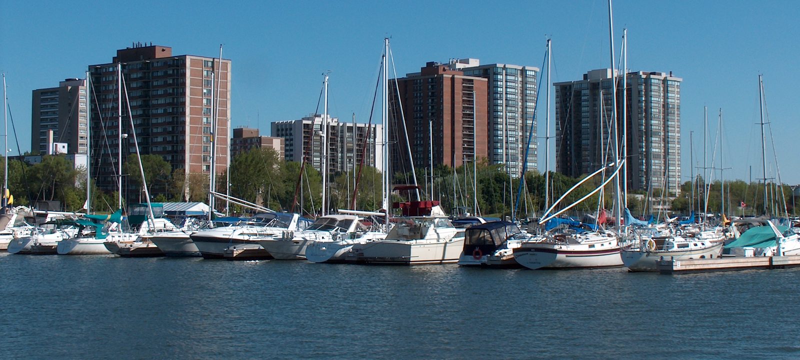
Sailboats moored in the Bronte Outer Harbour marina, with apartment buildings behind them under a clear blue sky
The Bronte Outer Harbour marina.
Photo: Decimal10, public domain

The west end

Bronte

Bronte began in 1834 as a small fishing village at the mouth of Twelve Mile Creek, often called Bronte Creek. It was named for Horatio Nelson, who was made Duke of Bronte. Some of its first settlers were United Empire Loyalists, and a few streets still carry their names. Early on, boats gathered flat stone from the shallows of the lake for building, a trade called stonehooking. The stone building at 49 Bronte Road, from about 1840, is one that survives, and the first harbour was finished in 1856.

Bronte today makes up much of Oakville’s west end. The village shops are around Bronte Road and Lakeshore Road, and the neighbourhood runs from Burloak Drive to Third Line and from the lake to Rebecca Street. Housing spread south of the QEW from the late 1950s, and north of it and west toward Burlington from the late 1980s. Lakeshore Woods was built in the 2000s where the Shell Research Centre used to be.

Parks and schools

Coronation Park, just east of Bronte on Lakeshore Road West, has sandy beaches, a large playground, and an outdoor stage. Bronte Creek Provincial Park covers the wooded northwest. Secondary schools include Thomas A. Blakelock and St. Thomas Aquinas, which offers the International Baccalaureate program. Just north of the QEW, between Bronte Road and Third Line, Deerfield is a golf course on Town owned land.

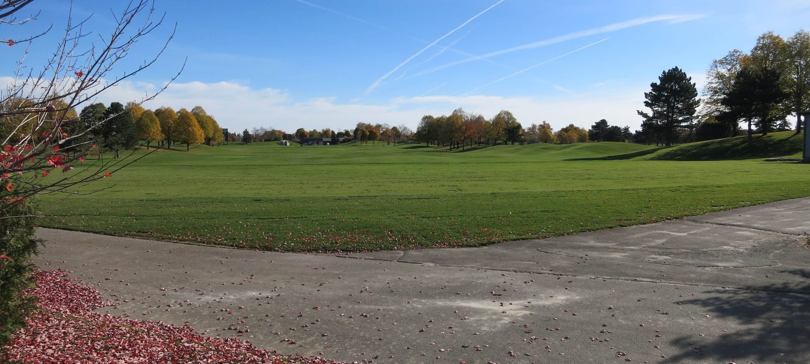
A fairway at Glen Abbey in late autumn, with fallen red leaves on a cart path and trees in fall colour
Glen Abbey in the fall.
Photo: Whpq, CC BY-SA 4.0

North of the QEW

Glen Abbey and the middle of town

North of the QEW, family neighbourhoods fill the land between the creek valleys. Glen Abbey takes its name from the Glen Abbey golf course, which Jack Nicklaus designed and which opened in 1977. It has hosted the Canadian Open 30 times. Plans to redevelop the course were withdrawn in 2021.

Oakville Trafalgar Memorial Hospital is on Hospital Gate, near Dundas Street and Third Line. Sheridan College’s Trafalgar campus, known for its arts programs, is on Trafalgar Road, and Oakville Place, an indoor mall, opened in 1981.

Neighbourhoods

Glen Abbey

Around the golf course, north of Upper Middle Road.

West Oak Trails

Further west, toward Bronte Creek.

River Oaks

North of Upper Middle Road, around River Oaks Boulevard.

Toward the 407

Uptown, Iroquois Ridge, and the north

The Uptown Core grew up around Trafalgar Road and Dundas Street, with shops, apartments, and a transit terminal on Oak Walk Drive.

Palermo, at Dundas Street and Bronte Road, was founded in 1805 by Lawrence Hagar from Pennsylvania and was called Hagartown until 1836, when it was renamed Palermo in honour of Horatio Nelson. North of Dundas, the town is building new neighbourhoods under its North Oakville plans, toward Highway 407. In the northwest of town, Oakville Executive is a public golf facility with 27 executive holes, which are shorter and make for a quicker round.

Neighbourhoods

Uptown Core

Around Trafalgar Road and Dundas Street.

Iroquois Ridge

East of Trafalgar Road.

North Oakville

The newest neighbourhoods, between Dundas Street and Highway 407.

Sources

We wrote this guide from the public sources listed here, and checked each place against them. Neighbourhood names follow local usage, the streets named are examples rather than boundaries, and the marks on the map are approximate. Details such as school boundaries, zoning, and transit routes change, so please check anything important with the municipality or the school board.