Across Ontario · Peel Region

Mississauga

West of Toronto on the lake: a city made from old villages and townships, with a tower filled City Centre and the Credit River running through the middle.

Map of Mississauga: main roads and highways, rivers, parks, and a few landmarks. Each part of town in this guide is marked; choose one to jump to itMississaugaLAKE ONTARIOEtobicoke Creek401403QEW410427Port CreditCity CentreStreetsvilleErin MillsMalton
Point to a part of town or a landmark, or tap itMap data © OpenStreetMap contributors
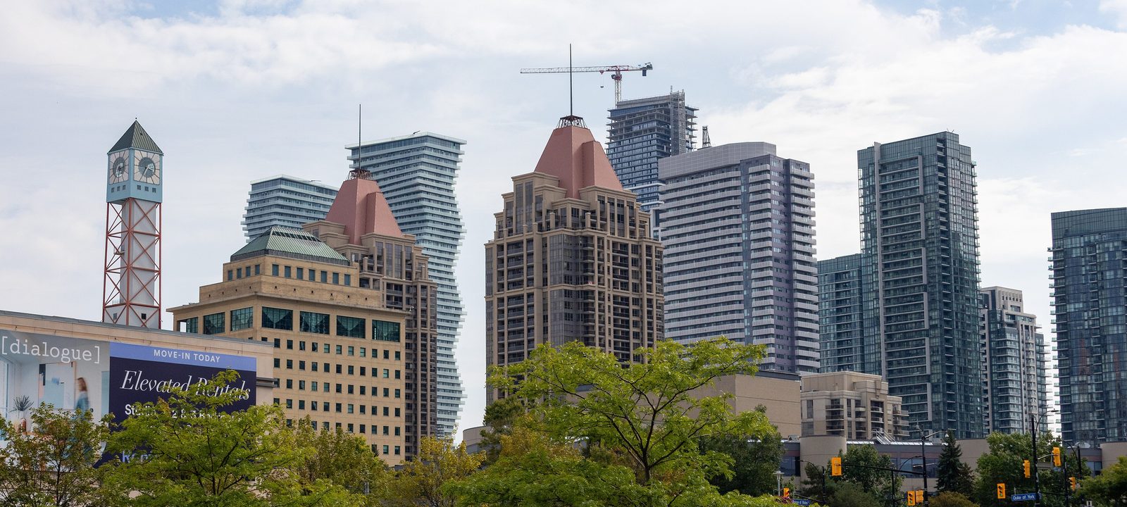
The towers of Mississauga City Centre on a bright day, with trees and a parking lot in the foreground
The towers of Mississauga City Centre.
Photo: Dillan Payne, CC BY-SA 4.0

About Mississauga

Mississauga is the third largest city in Ontario, home to about 718,000 people in 2021. It runs from Lake Ontario north to Brampton, between Toronto and Oakville, and it covers about 288 square kilometres with 13 kilometres of shoreline.

It is not one old town that grew. Most of it was Toronto Township, a rural area of farms, orchards, and small villages such as Clarkson, Cooksville, Dixie, Erindale, and Malton. After the Second World War, suburbs spread quickly. The township became the Town of Mississauga in 1968, and in 1974 it became a city and took in Port Credit and Streetsville, which until then had stayed independent.

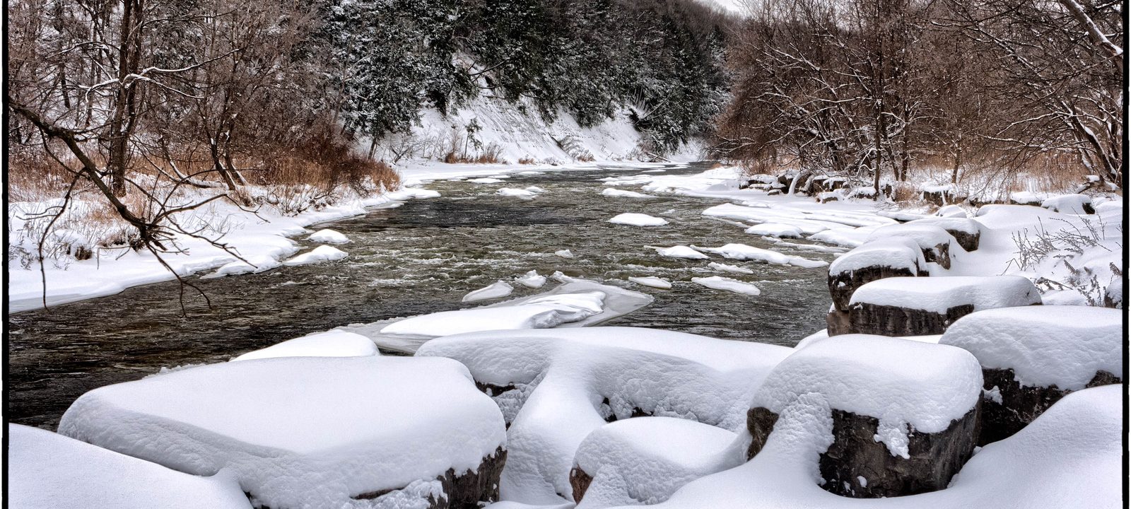
The Credit River runs through the middle of the city in a wooded valley, and Etobicoke Creek forms part of the line with Toronto. The guide starts at the lake.
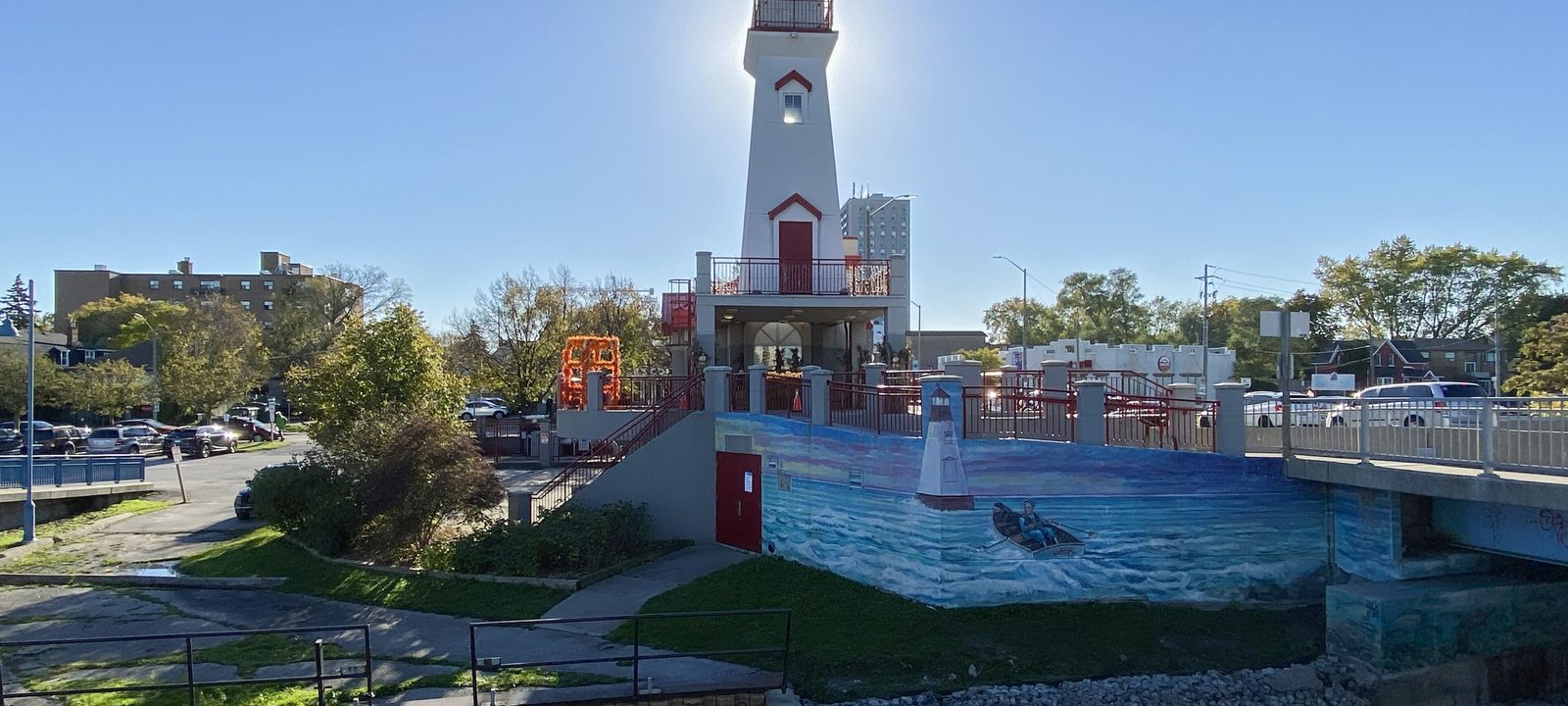
The Port Credit lighthouse, a white tower with a red top, beside the Credit River and a small park under a clear blue sky
The lighthouse at the mouth of the Credit River, in Port Credit.
Photo: Canmenwalker, CC BY 4.0

On the lake

Port Credit and the lakeshore

Port Credit sits at the mouth of the Credit River, around Lakeshore Road and Hurontario Street. It began as a Mississauga settlement and a trading post from 1720. After the War of 1812, a harbour was built here by the Mississaugas with European and Jamaican settlers. It was its own town from 1909 until 1974.

The old village core is a heritage conservation district, the harbour is mostly used for pleasure boats now, and newer condo buildings have brought many more people in recent years. Port Credit GO, on Queen Street East, is on the Lakeshore West line, which runs all day. Lakeview Golf Course, the City’s golf course on Dixie Road, has been on its site since 1907.

Along the shore

Lakeview

East of Port Credit toward Toronto, on Lakeshore Road. It was known for the four tall stacks of the Lakeview Generating Station, which came down in 2006.

Lorne Park

West of Port Credit, a residential area that began as a lakeside resort. Jack Darling Memorial Park, on Lakeshore Road West, is one of the city’s best known beaches.

Clarkson

In the southwest corner, beside Oakville, named for Warren Clarkson, who came from New York State in 1808. Rattray Marsh, with its boardwalk, is on the lake here, and Clarkson GO is on Southdown Road.

Downtown

The City Centre and Cooksville

Mississauga City Centre is a planned downtown built around Square One Shopping Centre, which opened in 1973 and is now the second largest mall in Canada. Towers spread out from Hurontario Street and Burnhamthorpe Road, and the newer high rise corridor runs along Confederation Parkway.

Mississauga Celebration Square, beside City Hall, hosts free concerts, movie nights, and a winter skating rink. Kariya Park, a Japanese garden named for the city’s sister city in Japan, opened nearby in 1992, and Sheridan College’s Hazel McCallion campus opened here in 2011.

Cooksville

Just south, Cooksville is one of the old Toronto Township villages, with its own GO station on the Milton line. Mississauga Hospital is on the Queensway West. The Hurontario LRT, under construction, will run from Port Credit through the City Centre to Brampton.

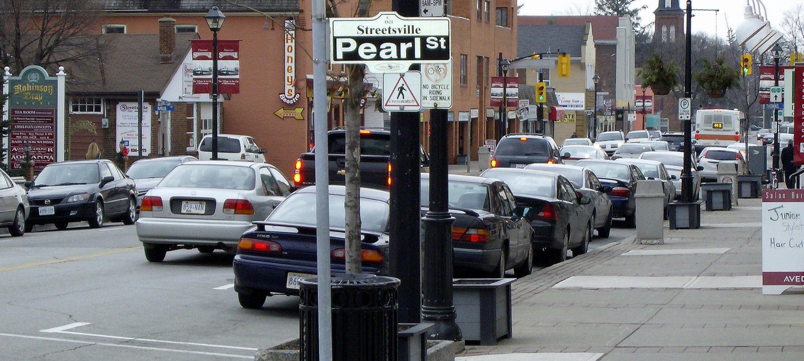
Queen Street South in Streetsville, with brick storefronts, a church spire, a street sign, and parked cars
Queen Street South, in the centre of Streetsville.
Photo: Mikerussell, CC BY-SA 3.0

Upriver

Streetsville and Meadowvale

Streetsville grew around the mills of Timothy Street, who helped survey the land before it opened for settlement in 1819. The general store from 1821, now called Montreal House, still stands on Queen Street South, and Street’s own house from 1825 is one of the oldest brick houses in Peel. Streetsville stayed a separate town until 1974 and has kept its old main street; Mississauga Road and Bristol Road are still called Queen Street and Main Street as they pass through.

Meadowvale, to the northwest, was started as a new town in 1969. Inside it, the old hamlet of Meadowvale Village, founded in 1836 on the Credit, was Ontario’s first heritage conservation district. Lake Aquitaine, in Meadowvale, has a boardwalk.

The Credit River in winter, flowing between snow covered rocks below a wooded valley slope
The Credit River valley in winter.
Photo: Joe deSousa, CC0

West of the Credit

Erin Mills and the west

Erin Mills was started as a new town in 1968, and it is now the most populous part of the city. It reaches from Dundas Street north to about Britannia Road, and from the Credit River west to Winston Churchill Boulevard. Erin Mills Town Centre, at Eglinton Avenue and Erin Mills Parkway, opened in 1989, and Credit Valley Hospital is close by on Eglinton Avenue West. BraeBen, one of the two golf courses the City runs, is in the west end too.

The University of Toronto Mississauga, here since 1967, sits on 225 acres of protected forest on the west bank of the Credit, across from the old village of Erindale. Erindale was called Springfield until 1890.

Further west

Churchill Meadows

The westernmost neighbourhood, between Winston Churchill Boulevard and Highway 407, north of Highway 403. It was part of Oakville until 1974.

The northeast

Malton and the east

Malton, in the northeast corner, is separated from the rest of the city by Toronto Pearson International Airport and its industrial lands. Its roads are named after cities in the United Kingdom, and Malton GO is on the Kitchener line. The airport opened as Malton Airport after land was bought in 1937, and it is now the busiest in Canada. By the airport, on Derry Road West, Derrydale is a public golf course that opened in 1970 and has had 12 holes since 2010.

In the east of the city, Applewood Acres, near the QEW and Dixie Road, was the first big planned suburb after the war. The Dixie Outlet Mall, which opened in 1956, was the township’s first mall.

Sources

We wrote this guide from the public sources listed here, and checked each place against them. Neighbourhood names follow local usage, the streets named are examples rather than boundaries, and the marks on the map are approximate. Details such as school boundaries, zoning, and transit routes change, so please check anything important with the municipality or the school board.