Across Ontario · The city

Toronto

Canada’s largest city, which is really a few hundred neighbourhoods. Here they are, part by part, from the towers downtown to the ravines, the main streets, and the quiet streets in between.

Map of Toronto’s 158 neighbourhoods, shaded by the part of the city they fall under in this guide, with the lakeshore, ravines, rivers, highways, main roads, the subway and LRT lines, and landmarks. Choose a neighbourhood to open its guide.DOWNTOWNNORTH YORKSCARBOROUGHETOBICOKEEAST YORKYORKMIDTOWNWEST ENDEAST ENDLAKE ONTARIO
Point to any of the 158 neighbourhoods or tap it; tap again to open its guideCity of Toronto Open Data and OpenStreetMap
  • Line 1 Yonge-University
  • Line 2 Bloor-Danforth
  • Line 4 Sheppard
  • Line 5 Eglinton
  • Line 6 Finch West
  • Ravines and parks
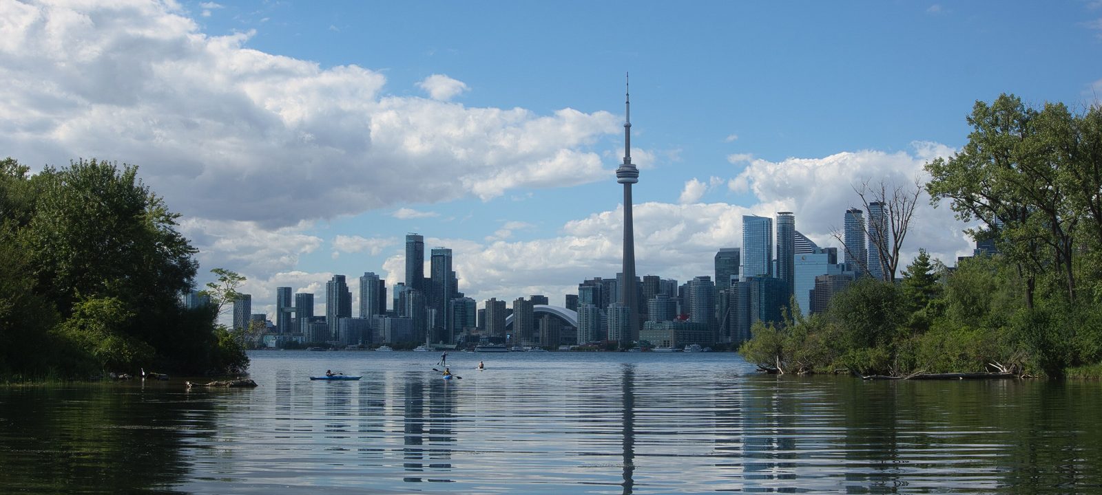
The Toronto skyline and the CN Tower across calm water from the Toronto Islands, with green trees on both sides and white clouds above
The skyline from the Toronto Islands.
Photo: Chicken4War, CC BY-SA 4.0

About Toronto

Toronto is the largest city in Canada and the capital of Ontario, home to about 2.8 million people in 2021. We have represented buyers and sellers across the city, from High Park and Trinity Bellwoods to Leslieville, and negotiated on their behalf from the first showing to closing day. The city sits on a harbour on the northwest shore of Lake Ontario, on a plateau cut by rivers and deep ravines. The British founded the town of York here in 1793, and it was renamed and incorporated as Toronto in 1834.

The city of today came together in 1998, when the old City of Toronto joined East York, Etobicoke, North York, Scarborough, and York. People still use those names, and each takes in dozens of neighbourhoods. The City itself divides Toronto into 158 official neighbourhoods, which you can see on the map above. Our guide groups them into the names people actually use, from the Annex and Yorkville to Leslieville and the Kingsway.

If you’re thinking of buying or selling anywhere in the city, or moving between Toronto and Waterloo Region in either direction, we can help with both ends. If it’s a part of the city we don’t know well, we’ll say so, and help you find the right agent through the RE/MAX network.

The core

Downtown and the waterfront

Union Station, on Front Street, is the hub for the subway, GO trains, VIA Rail, and the UP Express to Pearson. Around it are the towers of the Financial District, the theatres and stadiums of the Entertainment District, the old warehouses of King West, St. Lawrence Market, and the Distillery District, with the Toronto Islands a short ferry ride offshore.

In this part of the guide

Read the Downtown and the waterfront guide

West of Spadina

Queen West to Little Italy

West of the core, Queen Street West, Kensington Market, Chinatown, Trinity Bellwoods, Ossington, Little Italy, Harbord Village, Little Portugal, and Dufferin Grove make up some of the city’s best loved Victorian neighbourhoods, with streetcars on almost every main street.

In this part of the guide

Read the Queen West to Little Italy guide

North of Bloor

The Annex to Rosedale

North of Bloor Street, the Annex borders the University of Toronto, Yorkville has the city’s best known shops, and Rosedale, one of its oldest suburbs, sits among the ravines, with Summerhill and Deer Park along Yonge Street to the north.

In this part of the guide

Read the the Annex to Rosedale guide

Around Yonge and Eglinton

Midtown

Yonge and Eglinton is the centre of midtown, one of the city’s business districts outside downtown. Forest Hill, to the west, was its own village from 1923 until 1967. Leaside, to the east, was a town from 1913 and joined East York in 1967. Lawrence Park, north of Blythwood Ravine, was one of Toronto’s first planned garden suburbs, and Line 5 Eglinton now runs across them all.

In this part of the guide

Read the Midtown guide

West of downtown

The west end

High Park, opened in 1876 on land left to the city by John George Howard, anchors the west end, with Roncesvalles and Parkdale to the south and east, Swansea and Bloor West Village to the west, and the Junction, the Junction Triangle, and Corso Italia to the north.

In this part of the guide

Read the the west end guide

East of the Don

The east end

Across the Don River, Riverdale joined the city in 1884, Leslieville grew around George Leslie’s nurseries, and the Danforth became Greektown. Cabbagetown, just west of the river, has what its preservation association calls the largest continuous area of preserved Victorian housing in North America, and the Beaches take their name from four beaches on the lake.

In this part of the guide

Read the the east end guide

The two smaller boroughs

York and East York

East York, across the Don, and York, between the old city and the Humber, were the smallest of the six municipalities that joined in 1998. They take in Old East York, Thorncliffe Park, Humewood-Cedarvale, Little Jamaica, Mount Dennis, Weston, and Baby Point.

In this part of the guide

Read the York and East York guide

North of the 401, centred on Yonge

North York

North York runs from the Humber River east to Victoria Park Avenue, centred on Yonge Street north of the 401. Willowdale grew from the old postal villages of Newtonbrook, Willowdale, and Lansing along Yonge. Don Mills, planned in the 1950s and 1960s as a self contained new town, became the model for postwar suburbs across Toronto. Don Valley, one of the City’s golf courses, is here too, on Yonge Street near the 401.

In this part of the guide

Read the North York guide

West of the Humber

Etobicoke

Etobicoke runs from the Humber River west to Etobicoke Creek. Along the lake are the old lakeshore towns. Mimico, named after the passenger pigeon, was laid out in 1856 and governed itself from 1911 until it joined Etobicoke in 1967. Long Branch, in the southwest corner, began as a summer resort in the late 1800s and was a village from 1930 to 1967. Both have GO stations on the Lakeshore West line. St. George’s, the Stanley Thompson golf course that has hosted six Canadian Opens, is on Islington Avenue.

In this part of the guide

Read the Etobicoke guide

East to the Rouge

Scarborough

Scarborough is the eastern part of the city, from Victoria Park Avenue to the Rouge River. It takes its name from the English town, chosen in 1793 by Elizabeth Simcoe because the cliffs reminded her of it. The Scarborough Bluffs rise up to 90 metres above the lake for about 15 kilometres, and Bluffer’s Park is the one park below them with a beach. Scarborough has golf as well, from the City’s Tam O’Shanter course to the private Scarboro club, which opened in 1912.

In this part of the guide

Read the Scarborough guide

All 158 City neighbourhoods

The City of Toronto divides the city into 158 official neighbourhoods. Every one of them is covered in this guide, often together with its neighbours under the name people use day to day. Here is where to find each.

Show all 158 City neighbourhoodsShow less

Sources

We wrote this guide from the public sources listed here, and checked each fact against at least two of them. Neighbourhood names follow local usage, and the City of Toronto’s 158 official neighbourhoods are listed under each entry. The streets named are examples rather than boundaries. Details such as school catchments, zoning, and transit routes change, so please check anything important with the City, the TTC, or the school board.