Waterloo Region · The university city

Waterloo

A Mennonite mill village that became home to two universities and a good deal of Canada’s technology industry. A walkable Uptown, a big old park, and calm neighbourhoods to the west and east.

Map of Waterloo: main roads and highways, rivers, parks, and a few landmarks. Each part of town in this guide is marked; choose one to jump to itWaterloo85UptownUniversitiesWest sideEast side
Point to a part of town or a landmark, or tap itMap data © OpenStreetMap contributors
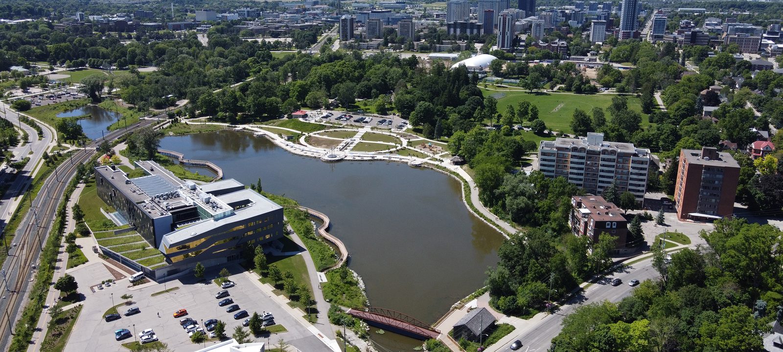
An aerial view of Waterloo Park and Silver Lake, with the towers of Uptown Waterloo and the city stretching to the horizon under a blue sky
Waterloo Park and Silver Lake, with Uptown beyond.
Photo: Canmenwalker, CC BY 4.0

About Waterloo

Waterloo began with Abraham Erb, a Mennonite settler from Pennsylvania who arrived in 1806 and bought land where the water could run mills. He built a sawmill in 1808 and a grist mill in 1816, and his two lots became the centre of the village. The Erb-Kumpf House, built around 1812, is likely one of the oldest homes in the city.

The township was named in 1816 after the Battle of Waterloo. The village was incorporated in 1857, became a town in 1876, and a city in 1948. For a long time it was known for insurance, and Mutual Life and Dominion Life both started here. The University of Waterloo, and later the technology companies that grew up around it, changed the city in the second half of the last century.

Waterloo and Kitchener sit side by side, and many people just say K-W, but each is its own city. This guide starts in Uptown, then goes to the universities and the streets around them, the west side, and the east side along the Grand.
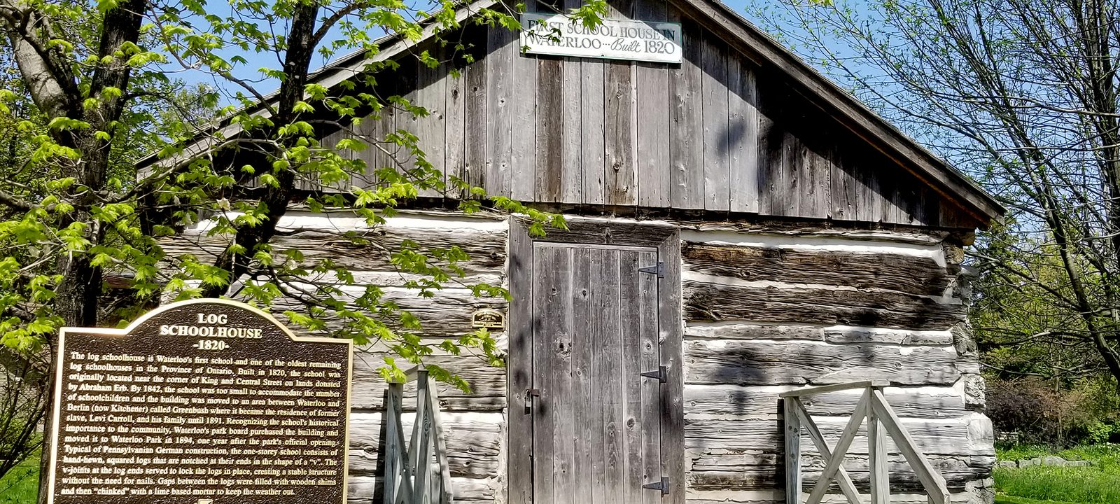
A small weathered log schoolhouse with a heritage plaque in front, among spring trees in Waterloo Park
Waterloo’s first school, built in 1820 and now in Waterloo Park.
Photo: Peter K Burian, CC BY-SA 4.0

The centre

Uptown and Waterloo Park

Uptown is Waterloo’s old main street, along King Street around Erb and Willis Way. The Waterloo Public Square is the meeting place, and the Waterloo Busker Carnival has filled it every August since 1989. The ION light rail runs right through it. Southwest of Uptown, just over the Kitchener line, Westmount Golf and Country Club is the private golf club the Westmount neighbourhood grew around.

Waterloo Park, created in 1890, is the oldest park in the city and covers about 45 hectares at the edge of Uptown. It has Silver Lake, an animal farm, sports fields, and a splash pad, and the Laurel Trail runs through it. The log schoolhouse that was Waterloo’s first school, built in 1820 on land Abraham Erb gave, now stands in the park.

A few steps away

The Canadian Clay and Glass Gallery and the Perimeter Institute for Theoretical Physics are both on Caroline Street North, a short walk from the square. Waterloo Collegiate Institute is on Hazel Street, north of Uptown, and St. David Catholic Secondary School is on High Street.

Neighbourhoods

Uptown

Older homes and new apartment and condo buildings mixed together around King Street. Most of what you need is within walking distance, and the ION is at the corner.

Mary Allen

East of King Street, between Uptown and the Kitchener line. Small older homes on quiet streets, a short walk from Uptown.

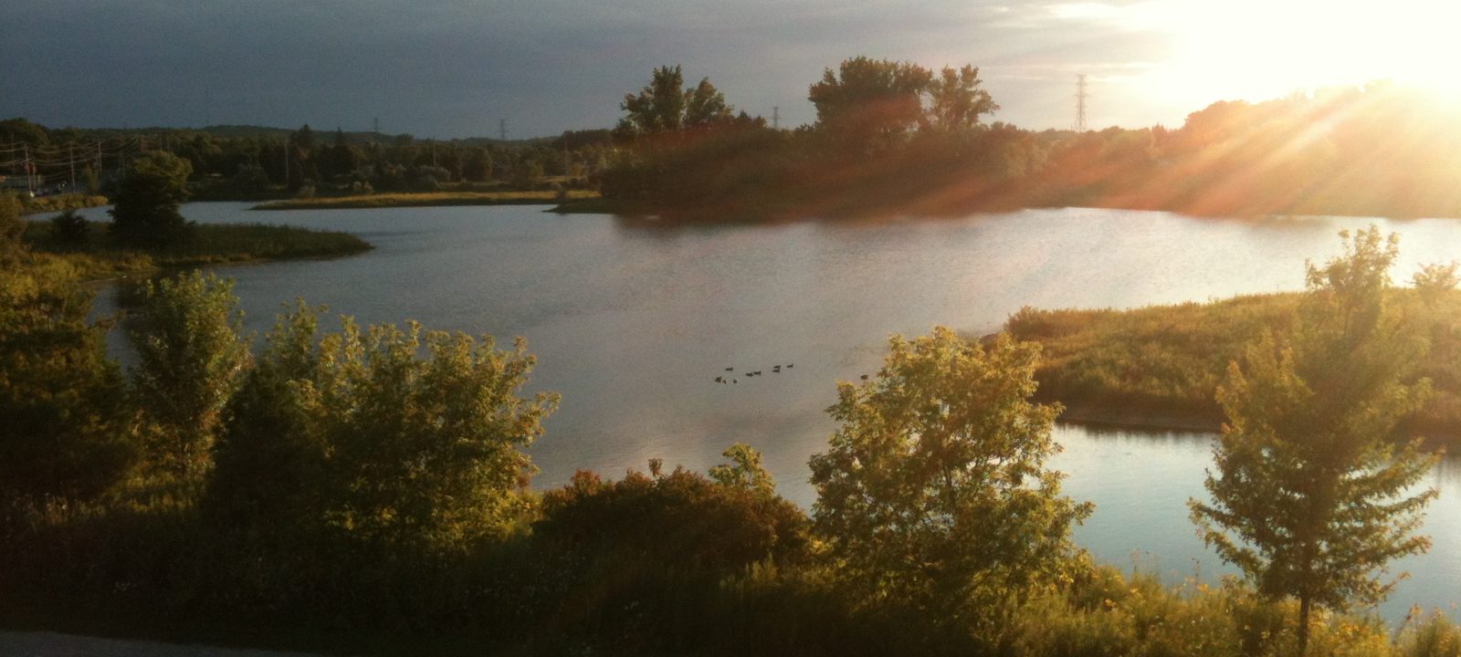
Sunlight breaking over Columbia Lake at the University of Waterloo, with trees and wetland along the shore
Columbia Lake on the University of Waterloo lands.
Photo: Samin Riasat, CC BY-SA 4.0

North of Uptown

The universities and Northdale

Wilfrid Laurier University began in 1911 as the Waterloo Lutheran Seminary, a few blocks from Uptown. The University of Waterloo came later and grew quickly, and it now has the largest post-secondary co-op program in the world. Its lands take in Columbia Lake and part of Laurel Creek, and the Laurel Trail follows the creek through campus.

BlackBerry, which began in Waterloo in 1984 as Research in Motion, has its headquarters here, and many technology companies have offices near the University of Waterloo. Conestoga Mall, at the north end of the ION line, is the main shopping centre on this side of the city.

Neighbourhoods

Northdale

Between the two universities. Many homes here are student rentals, and newer apartment buildings are going up.

Lakeshore

North of the University of Waterloo, near Columbia Lake and Laurel Creek. Quiet residential streets with parks and trails close by.

Lexington

In the northeast, near Conestoga Mall and the Conestoga Parkway. Family streets around Lexington Park.

On the moraine

The west side

West of the universities, the city spreads over the gentle hills of the Waterloo Moraine, which supplies drinking water to more than 300,000 people in the region. The neighbourhoods are mostly residential, with curving streets, parks, and trails linking them. Out on Ira Needles Boulevard, the Badlands is a nine hole par 3 golf course that is open to everyone.

Laurel Creek Conservation Area, in the northwest, has a reservoir, campsites, trails, and room for canoeing and sailing. Laurel Heights Secondary School is on Laurelwood Drive, and the Columbia Forest woods are at the western edge.

Neighbourhoods

Beechwood

Just west of the University of Waterloo. Established streets of detached homes with mature trees.

Westvale

In the southwest, near the Kitchener line. Residential streets close to shopping on the main roads.

Laurelwood

Around Laurelwood Drive, near Laurel Creek Conservation Area and Laurel Heights Secondary School. Family homes on curving streets.

Clair Hills and Vista Hills

Toward the western edge of the city, among the newer neighbourhoods in Waterloo, close to the Columbia Forest woods.

Erbsville

An old crossroads hamlet at the western edge, now with new streets growing around it.

Toward the river

The east side and the Grand

The Grand River runs along the east edge of Waterloo, and the 76 kilometre Walter Bean Grand River Trail follows it. RIM Park, which opened in 2001 and covers about 123 hectares, has sports fields, rinks, and diamonds, and it sits beside the Grey Silo golf course and the library’s Eastside Branch. Bechtel Park, about 44 hectares, is nearby with a dog park and soccer fields.

Bluevale Collegiate Institute is on Bluevale Street North, and the Conestoga Parkway and the road north to St. Jacobs are both close.

Neighbourhoods

Eastbridge

In the northeast near the Grand River, among the newer neighbourhoods in Waterloo, close to RIM Park and the river trail.

Around Bluevale

Between Uptown and the river, around Bluevale Collegiate. Established family streets close to Bechtel Park.

Sources

We wrote this guide from the public sources listed here, and checked each place against them. Neighbourhood names follow local usage, the streets named are examples rather than boundaries, and the marks on the map are approximate. Details such as school boundaries, zoning, and transit routes change, so please check anything important with the municipality or the school board.