Waterloo Region · The rural northwest

Wellesley

The quiet northwest corner of Waterloo Region: rolling farmland, Mennonite roots, and a handful of small villages, the largest of them on a pond on the Nith River.

Map of Wellesley: main roads and highways, rivers, parks, and a few landmarks. Each part of town in this guide is marked; choose one to jump to itWellesleyConestogo RiverWellesleySt. ClementsLinwoodBamberg
Point to a part of town or a landmark, or tap itMap data © OpenStreetMap contributors
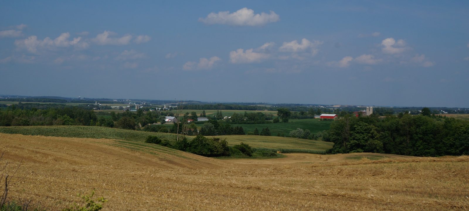
Rolling hills of harvested fields and green woodlots in eastern Wellesley Township under a blue summer sky
The rolling hills of eastern Wellesley Township, from Hackbart Road.
Photo: JFVoll, CC BY-SA 4.0

About Wellesley

Wellesley is the rural northwest township of Waterloo Region, about 278 square kilometres of farms, woodlots, and small villages. Its communities are Wellesley village, St. Clements, Linwood, Hawkesville, Crosshill, Bamberg, Dorking, and Kingwood, and the township office is in St. Clements.

The township was surveyed only in 1842 and 1843. Before that it was part of the Queen’s Bush, crown land with a large Black settler population, where fifty acre lots were given to people who would farm them. German settlers followed, and Mennonite families have farmed here for generations, especially around Hawkesville.

The guide goes village by village, starting with Wellesley itself.
On the Nith

Wellesley village

Wellesley village was first settled in 1847 by John Smith and was called Schmidtsville at first. When the post office opened in 1851 it was renamed for Richard Wellesley, the elder brother of the Duke of Wellington. It soon became the main trading centre for the farms around it, and the mill built in 1856 still stands.

The Wellesley Pond is the centre of village life. The Wellesley Apple Butter and Cheese Festival has been held on the last Saturday of September since 1975, the Wellesley Fall Fair fills the community centre grounds in September, just after Labour Day, and the fishing derby on the pond is on Labour Day Monday. Wellesley Apple Products has been here since 1922.

Newer homes

The village is on municipal water and sewer and has grown in small steps. On the west side, the Village Estate subdivision near Greenwood Hill and Gerber Road was built out in six phases with single and semi detached homes. In 2018 the township approved another small subdivision on Ferris Drive, just east of Wellesley Public School, and in 2025 council approved a plan for up to 169 more homes on Gerber Road, with detached homes, semis, and townhouses, a park, and a trail.

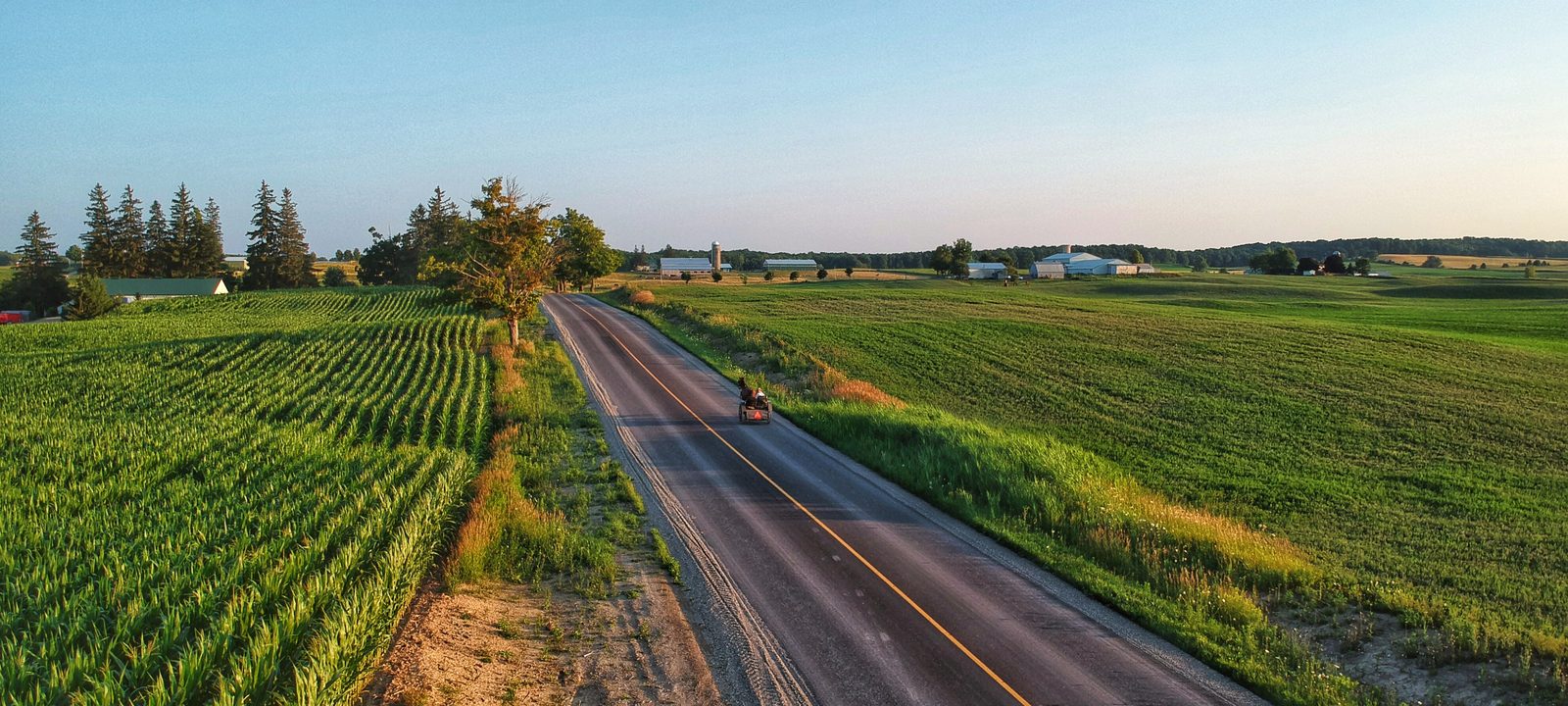
A quiet paved country road running between green cornfields near St. Clements in early evening light
A country road near St. Clements.
Photo: ThoughtfulCub, CC BY-SA 4.0

The east end

St. Clements and Heidelberg

St. Clements was settled in 1840 by Michael Spiehlmacker, and its first families were German Catholics from Alsace and Lorraine. The first church was built of logs, and by 1853 it was already too small. The large brick St. Clement church followed in 1858. When it opened it was said to be the largest and finest church west of Toronto. The township office and a library branch are in the village today.

Heidelberg, a few minutes east, was settled in the 1840s and sits on the line with Woolwich Township. It is the closest of the Wellesley villages to Waterloo.

The north end

Linwood, Hawkesville, and the north

Linwood is the main village in the north of the township, home to about 730 people in 2021. Jones Feed Mill, a family run business for almost a century, is the township’s largest employer, and the Linwood library branch is here too.

Hawkesville began in 1837 when John Philip Schweitzer cleared land on the Conestogo River. John Hawke later bought the clearing on the condition that he build a grist mill and a sawmill, and the village took his name. Hawke was Wellesley’s first reeve, and he cast the deciding vote that made Berlin, now Kitchener, the county seat. Mennonite families farm much of the land around the village, and Hawkesville is known for its custom furniture makers.

The south end

Crosshill, Bamberg, and the southwest

Bamberg’s first settlers came from Germany, and the village was called Weimar until 1852. Paradise Lake, nearby, has had a children’s summer camp on its shore since 1924. Camp Ki-WaY was run by the Kiwanis Club until 2009, when it was given to the YMCA.

Crosshill is a crossroads community in the west of the township, surrounded by farms.

Sources

We wrote this guide from the public sources listed here, and checked each place against them. Neighbourhood names follow local usage, the streets named are examples rather than boundaries, and the marks on the map are approximate. Details such as school boundaries, zoning, and transit routes change, so please check anything important with the municipality or the school board.